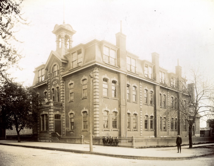
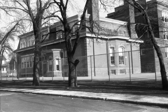
The Chinese in Early 20th Century Toronto: 82 Gladstone Avenue

In Valarie Mah’s paper Bachelor Society, in 1900, 82 Gladstone Avenue was occupied by Chinese immigrant Lew Mo Kee. According to the city directories, 82 Gladstone was vacant before Kee resided in 1900-1901 being the first Chinese resident to make it a laundry business. After his departure in 1901, another Chinese resident, Bong Mark, continued the laundry business and after 4 years in 1905, the business previously occupied by Wood Yong still remained. It appears the occupation of running a laundry lacked permanence and was a mere response to “the demand of rapidly growing urban economy by providing quality, low cost laundry service to a workforce of single men” (Mah, 40). Interestingly, prior to Kee’s moving, 82 Gladstone in 1898 was a Public School with the tenant and caretaker, Ritchie Duncan. The progression of this area is evident through the changes of residence and the use of building.

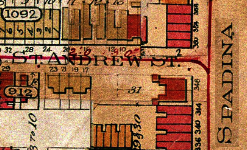
According to taxes of 1901, Kee was a tenant at 82 Gladstone which was owned by Matthew Parsons, owner and trustee of the Presbyterian Church. Mah reports there are three other Chinese immigrants taking residence in the same building. However, observing the accessible rolls of 1900 in Ward 6 division 2, it seems that this number may be an error and that there were actually five individuals are connected to the residence. In others words, it is possible that Kee was living with his family in 82 Gladstone Avenue.  Chinese immigrants living with their families in the early 1900s were, however, a rare phenomenon. Most in men in Toronto Chinatown were “bachelors” and “there were only 13 Chinese families among 2035 Chinese in the city in 1921(Mah, 37), therefore there must have been even less Chinese families in Toronto in 1900. Furthermore, a headtax for Chinese coming into Canada had been established and the “$50 a head was a financial hardship” for the Chinese making it very hard to believe that the residents as 82 Gladstone Avenue were Lew Mo Kee’s actual family (Mah, 27).

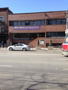
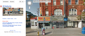
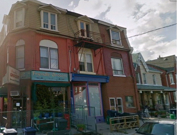
Currently, 82 Gladstone Avenue is a grocery store called “Friendly Grocery”.

82 gladstone friendly groceryfriendly grocery- glad
Works Cited:

Mah, Valerie. “The “Bachelor” Society”. A Look at Toronto’s Early Chinese Community from 1878 – 1924 (unpublished, 1978).

Google Maps: 82 GLadstone Avenue. https://maps.google.ca/maps?hl=en-CA&gbv=2&q=82+gladstone+avenue&ie=UTF-8&hq=&hnear=0x882b3455204114fb:0x42d42d4448af7867,82+Gladstone+Ave,+Toronto,+ON+M6J+3K7&gl=ca&ei=S7dIU7CUO6qw2wWL9ICADg&ved=0CB4Q8gEoATAA. Web. Last accessed 11 April ,2014.

Toronto City Directory (1898-1902, 1905); Toronto Archives

Google map:
Goads Fire Insurance Plan (1899); Toronto Archives Website


The Chinese in Early 20th Century Toronto: 133 Argyle

Based on the information obtained about this address from the City of Toronto Archives/City Directory, in 1900, 133 Argyle was owned by James and Heffer, however the tenant was Charlie Louie. When Louie was at this address, according to the Toronto Assessment Rolls, he was conducting a laundry business.  The Assessment Rolls also indicate that Louie was identified as a 41 year old Christian man and was the only person living at the address. He had no family members with him. Twenty years later (1920), Charlie was still doing the laundry business at this address.
The images below shows Argyle Street in the early 20th century.

Argyle1906

133Argyle St

The Chinese in Early 20th Century Toronto: 202 St. Patrick Street

Toronto Chinese Catholic Centre (present)

Toronto Chinese Catholic Centre (present)


Our Lady of Mount Carmel Church (present)

Our Lady of Mount Carmel Church (present)


202 St. Patrick Street in Toronto, Ontario is currently a community centre for those of Chinese heritage.  The Toronto Chinese Catholic Centre is connected to a Chinese Roman Catholic Church entitled “Our Lady of Mount Carmel Church”.  However, 202 St. Patrick Street was not always a community centre.  Through the assistance of the City of Toronto Archives, I was able to conclude that the location was actually a Roman Catholic school in the early 1900s. In fact, the location was not even known as “202 St. Patrick Street”.  Pre-1900s to 1920’s, the street St Patrick was called Williams Street and the lot number was 208.  William Street intersected with Caer-Howell Street (now Elm Street) and Anderson Street (now Dundas St. West).  The name of the school is referenced in the maps as “St. Patrick’s School”, however, in other records, the name is disclosed.


Even in the early 1900s, the school (along with other prominent establishments, like the “Planning Mill”) was one of the few brick-built structures in the area.  Most houses near the school were wooden .  The school and church were able to build an additional cathedral beside “Our Lady of Mount Carmel” by the year 1913, the reason is unknown.  By 1913, the school was now considered as lot 202 but the street name was still Williams Street.


1989

1989


1913

1913


1924

1924


Assessment Role Findings

202 St. Patrick Street was classified as “separate school” in the 1901 Assessment Roles.  This is important because it was not considered a public establishment, thus the taxation rate was paid differently.  The owner name is indicated by 1914.  “J. Hall” who lives at 28 Duke Street was considered the owner of the school at the time.  As the 1922 Assessment Role indicates, “J. G. Hall” seems to keep the building through the 1920’s as well.


The size of the lot was 79×126 meters.  This lot size remains unchanged from 1901 through 1922 showing a lack of additions made to school over the years.  Another indication that the building was not added to is the “Value of the Building”.  The “Value of the Building” remains at $4000 throughout the years 1901 through 1922.  However, the “Value of Land” began to increase substantially.  The land cost grew from $3160 in 1901 to $8690 in 1913.


The number of tenants is always listed as “X” indicating there is nobody who was living at 202 St. Patrick Street at any point of its establishment.  Another (rather obvious) side note is that the school is labelled “Exempt” when mentioning livestock or crop production.

The Chinese in Early 20th Century Toronto: 636 Yonge Street

According to the city of Toronto directories, 636 Yonge Street, was non-existent in 1880 and in 1900. However, in the 1920 City Directories, the address appeared, as did the name of tenant. Based on the city directories, at this address a Chinese Laundry business was being operated by Sam Wo, the tenant of the address at the time. More information on this address was not found on the City Assessment Rolls of 1920, but it was found for 10 years later (1930). In 1930, this address was still being operated as a Chinese laundry by Sam Wo, who at the time, was 52 years of age. The owner of the address at the time was ‘Mcwhimmery William’. On the assessment rolls it showed that Sam Wo’s religion was identified as ‘Chin’.
There were no specific old pictures found of this address, however, the uploaded pictures here just show how yonge st looked like in 1912 and in 1934. These pictures were taken online from ‘Toronto’s amazing intersection at Yonge and Front Streets’: http://tayloronhistory.com/2013/03/25/torontos-amazing-intersection-at-yonge-and-front-streets/
Yonge St1912

yongeSt1930s

The Chinese in Early 20th Century Toronto: 956 Queen Street West

990 Queen St West (1917)956-52 Queen St W (2014)

Provincial Lunatic Asylum (CAMH today)


Wu Chong was a tenant at 956 Queen St. West, owned by James Hunter, and operated a laundry mat from that location. According to the Toronto Street Directories, the property was listed under Sells H & Sons, assumed to be Hunter & Sons, in 1889 and “Wer. Chong” became a tenant in 1890. The name “Wer. Chong” may be an interpretation of his name by the person filling out the assessment. According to the Assessment Roll of 1900 and Valerie Mah’s “The Bachelor Society”, there is only one person listed under this address, meaning that Wu Chong was either a bachelor or working and sending money home to his family in China. It can be confirmed that Chong operated from that establishment from 1890-1917. However, beginning in 1917, the establishment is listed in the Toronto Directory as “Chinese Laundry”, which may have still been operated by Chong. The property is located across from what was then known as the Provincial Lunatic Asylum (known today as the Centre of Addiction and Mental Health (CAMH)). The appearance of the shop can be assumed to be similar to the properties shown in the photo above of 990 Queen St West in June of 1919. The location is currently occupied by the Museum of Contemporary Canadian Art (MOCCA) and will be replaced by condominiums as part of a redevelopment plan.

Works Cited:

Assessment Roll (1900) Ward 5 Division 1; City of Toronto Archives.

Mah, Valerie. The bachelor society: a look at Toronto’s early Chinese community from     1878-1924. MA Thesis. 1978. Print.

Provincial Lunatic Asylum (June 1973). Public Works Photographs. Series 372, Item 69. City of Toronto Archives.

Toronto Directory (1889-1917); City of Toronto Archives.

990 Queen St W (June 17, 1919). Public Works Photographs. Series 372, Item 811. City of Toronto Archives.

The Chinese in Early 20th Century Toronto: 352 Spadina Ave., Toronto, Ontario, Canada

352 Spadina Ave. 1903 Map: Clip from Plate 23 of Goad's Fire Insurance Plans

352 Spadina Ave. in 1903 Map: Clip from Plate 23 of Goads Fire Insurance Plans


352 Spadina Ave. 2014 Google Maps

352 Spadina Ave. in 2014 Google Maps

In accordance with Valerie Mah’s research, the City of Toronto Directories from 1900 and the Tax Assessment Rolls from 1901 do verify that, at that time, 352 Spadina Ave. was occupied by a person by the name of Mah Tang.

Valerie Mah’s research (in her thesis The Bachelor Society A Look at Toronto’s Early Chinese Community 1878-1924), which included a letter from Thomas Humprhies to Reverand MacKay, listed 95 Chinese establishments in Toronto on July 25 1900. That letter stated that 352 Spadina Ave. was occupied by Mah Tang and 3 other Chinese people.

The Tax Assessment records from 1901 state that Mah Tang was a tenant of Thomas Hook. His occupation is listed as “laundry.” Mah Tang’s business must have run out of the street-level portion of the building, because there is tax listing for another tenant that lived “over 352” named Patterson John J. (This upstairs tenant was recorded as 44 years old, with 6 family members, 3 children. The owner of the upstairs property was Edward Leadlay). Mah Tang was recorded to have 2 “Persons in Family” and no children.

According to Goads Fire Insurance Plans from 1903 (image attached), this building was located at the North-Western corner of the intersection of Spadina Ave. and St. Andrew St. In these plans, the building is coloured red, which indicates that it was a brick building.

Today that building bears the same address and is home to Minh Cau Jewellers who sell jewellery, watches and optical glasses (storefront image attached). Their website can be seen here: http://www.minhchau.ca/

___________________________

WORKS CITED

City of Toronto. Tax Assessment Rolls. Ward 4 Division 3 (1901). Reel 148, Location 264736:40. Microfilm. Pg. 50.

City of Toronto. Directories (1900). Reel 46. Microfilm. Pg. 233.

Mah, Valerie. The Bachelor Society: A Look at Toronto’s Early Chinese Community from 1878-1924. MA Thesis. 1978. Print.

Letter from Humprhies to Rev. MacKay, July 25, 1900, File 33, Box 1, United Church Archives, as noted in Mah 19.


460 Spadina Ave., Toronto, Ontario, Canada

According to the City of Toronto Directories, the first building constructed on the site of 460 Spadina must have been established around 1888. This seems to be the case because, in 1887, lots 365 – 497 where College St. intersects were listed as: “stables, house, private grounds, Methodist Church, vacant lot, unfinished house, vacant, vacant, vacant lot.” In the City Directories for 1888, lot 460 is listed under “White Alfred.” Alfred White was the registered in the City of Toronto Tax Assessment Rolls for St. Patrick’s Ward in 1888: aged 42, occupation was “gents furnishing” with 7 family members. The size of the lot of land was 234 x 188 and on that lot was a brick building sized 18 x 266 / 14 x 31.

460 Spadina Ave. 1903 Map: Clip from Plate 23 of Goads Fire Insurance Plans

Map c. 1903: Clip from Plate 23 of Goads Fire Insurance Plans

c. 1927 on Spadina Ave., looking south to College St.

c. 1927 on Spadina Ave., looking south to College St.

According to Goads Fire Insurance Plans from 1903 (above), this building was located at the South-Western corner of the intersection of Spadina Ave. and College St. In these plans, the building is coloured red, which indicates that it was, indeed, a brick building. The photo (above) shows what the intersection looked like during the late 1920’s.

c. 2012: Outside the 460 Bistro Bar

Today: Outside the 460 Bistro Bar (c. 2012).

c. 2012: Inside the 460 Bistro Bar with Mona behind the cashier.

Today: Inside the 460 Bistro Bar with Mona behind the cashier (c. 2012).

Today that building bears the same address and is home to The 460 Bistro Bar. The woman who runs the business is named Mona and she moved from Southern China under a decade ago. Her bar has become somewhat of a legend among Toronto’s underground art and music scene.

The 460’s website can be seen here: https://www.facebook.com/pages/The-460/103511123019232

c. 1990s: Just north of 460 Spadina Ave. is the El Mocombo (464 Spadina Ave.)

Mona recalls that the previous business owner of 460 Spadina was a Vietnamese man named John. The City of Toronto Directories for 2001 do in fact list “John’s Restaurant” at that address.

Mona also recalls that before John, two Chinese women named Nancy and Michelle ran a restaurant and bar that served breakfast, lunch and dinner – apparently it was quite popular among University of Toronto students. The City of Toronto Directories for 1980 and 1990 simply list “Coffee Shop.”

_____________________________

CITATIONS

City of Toronto. Tax Assessment Rolls. St. Patrick’s Ward (1888). Microfilm. Pg. 81.

City of Toronto. Directories (1887). Microfilm. Pg. 213-214.

City of Toronto. Directories (1888). Microfilm. Pg. 248.

City of Toronto. Directories (1955). Microfilm.

City of Toronto. Directories (1980). Microfilm. Pg. 783.

City of Toronto. Directories (1990). Microfilm. Pg. 445.

City of Toronto. Directories (2001). Microfilm.

The Chinese in Early 20th Century Toronto: 84 Ulster Street

The address I chose to do was 84 Ulster street. Mainly because I have never heard that street name before and I figured it would be fun to figure out the history of it. It was a thrilling experience until I realized I would have to scroll through many pages of film to get to the name listed at the address. When I first started to look for the address in the fire plans I found that 84 Ulster street was in Ward 4 division 2. After figuring out the ward went into the roll of 1899, and decided to see who lived there at the time and what occupation they may have had. Then I stumbled onto this: 84 Ulster Street was the location of a laundry owned by Bing Lee. The laundry was named Peoples Loan Company. By 1903, 84 Ulster, also a laundry, was owned by a Lem, Yong.


Works Cited:

Assessment Roll: Ward 4 Division 2 1899

Assessment Roll: Ward 4 Division 2 1903


The Chinese in Early 20th Century Toronto: 225 Church Street

Around the turn of the century, 225 Church Street around Church and Wilton (Dundas was formerly known as Wilton) was a laundry owned by a man named Long Fung. The laundry was made of wood and and existed on the east side of the street. Today, 225 Church Street is the Sabai Sabai Kitchen and Bar, a Thai restaurant.

Sources


Toronto archives:

Fonds 200, Series 372, Subseries 58, Item 28

The Chinese in Early 20th Century Toronto: 309 College Street

According to Valeria Mah’s thesis paper The Bachelor Society, 309 College Street in the early 1900s was occupied by a Chinese bachelor named Charlie Lung. However according to information gathered from the 1899 and 1903 Goad’s Fire Insurance Plans, the 1900 and 1901 Toronto City Directories and the Toronto Assessment Rolls there was no one living at that address. In fact, there was no building at 309 College Street. It was an empty lot according to the Goad Insurance Maps with no structures.

Despite this anomaly, Charlie Lung does appear in the City Directories of 1900 and 1901 however he is listed at 697 Yonge Street not 309 College. This could mean that there were more than one Charlie Lung’s in Toronto. The 1898 Assessment Roll has no listing for 309 College Street but there is a Charlie Lung listed at 313 College Street. According to the information, Lung ran a laundry, was the householder, and lived alone. There were no other listed tenants or family members. The building itself was owned by Florence (last name is illegible) from Montreal.

However in the 1901 Assessment Roll, Charlie Lung is listed at 313A College Street owned by Gordon Jones. He still ran a laundry business and was a householder. This might be explained by the rapid growth of the city which altered street numbers. It is not likely that Charlie Lung moved his laundry down one house between 1898 and 1901 therefore it is probable that it was the street numbers that altered.

In both Assessment Rolls, Lung’s religion is listed as Chinese. This listing of Lung’s ethnic and racial background as a religion highlights the ‘othering’ of the Chinese in Toronto at the time and the ignorance of Chinese culture.

Works Cited

Assessment Roll (1898): Ward 4 Division 2; City of Toronto Archives.

Assessment Roll (1901): Ward 4 Division 2; City of Toronto Archives.

Goad’s Fire Insurance Map (1899 & 1903); City of Toronto Archives Website.

Mah, Valerie.  The “Bachelor” Society. A Look at Toronto’s Early Chinese Community from 1878 – 1924 (unpublished, 1978).

Toronto City Directory, 1900 & 1901; City of Toronto Archives.